

SEVERE WEATHER BULLETIN #18 FOR:Typhoon #OmpongPH
- TBN News

- Sep 15, 2018
- 2 min read
Tropical Cyclone: WARNING
ISSUED AT:2:00 PM, 15 September 2018
TYPHOON "OMPONG" MAINTAINS ITS STRENGTH AS IT MOVES IN A WEST NORTHWESTWARD DIRECTION
• Stormy weather is expected over the areas under TCWS # 2 and #3.
• The Southwest Monsoon (Habagat) enhanced by the typhoon will bring gusty winds with occasional moderate to heavy rains over Western Visayas, Zamboanga Peninsula, ARMM, MIMAROPA and Bicol Region while scattered light to moderate to at times heavy rains over Eastern and Central Visayas. Residents in these areas, especially those living near river channels, in low-lying areas and in mountainous areas, are advised to take appropriate actions against possible flooding and landslides, coordinate with local disaster risk reduction and management offices, and to continue monitoring for updates.
• Possible Storm surge height in surge prone areas: up to 3 meters in Ilocos Norte and Ilocos Sur; up to 2 meters in La Union and Pangasinan.
• Fisherfolks and those with small seacrafts are advised not to venture out over the seaboards of areas with TCWS and the seaboards of Luzon and of Visayas and northern and western seaboards of Mindanao.
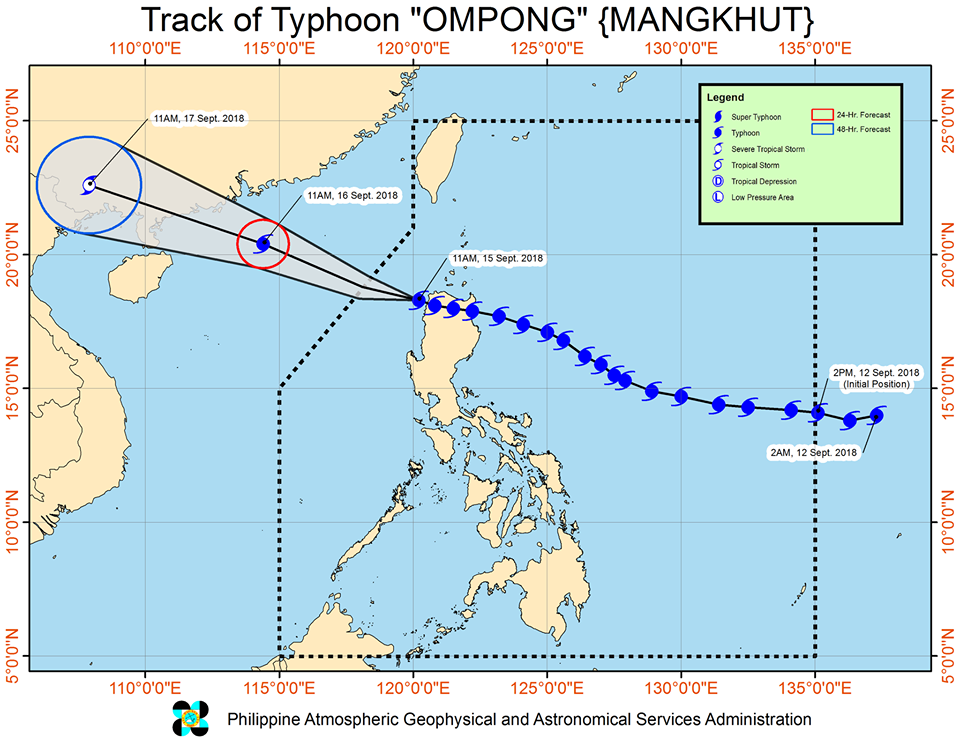
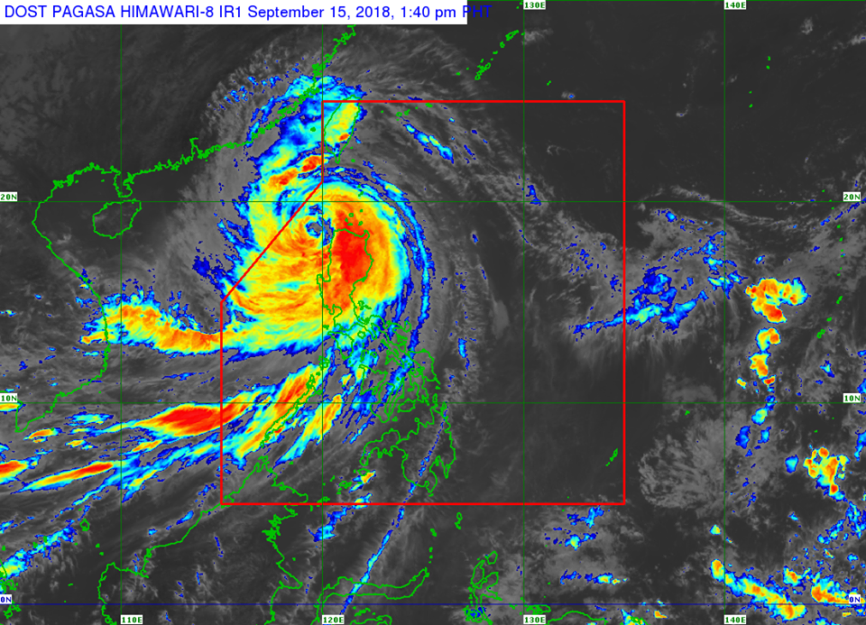
Location of eye/center: At 1:00 PM today, the eye of Typhoon "OMPONG" was located based on all available data at 85 km West of Laoag City, Ilocos Norte (18.3 °N, 119.8 °E)
Strength: Maximum sustained winds of 170 km/h near the center and gustiness of up to 260 km/h
Forecast Movement: Moving West Northwest at 25 km/h
Forecast Positions:
24 Hour(Tomorrow morning): 695 km West Northwest of Laoag City, Ilocos Norte (OUTSIDE PAR)(20.4°N, 114.4°E)
48 Hour(Monday morning):1,410 km West Northwest of Laoag City, Ilocos Norte (OUTSIDE PAR)(22.6°N, 107.9°E)
TROPICAL CYCLONE WARNING SIGNAL
TCWS #3 (Winds of 121 -170 kph is expected in at least 18 hrs)
Cagayan incl. Babuyan Group of Islands, Batanes, Ilocos Sur, Ilocos Norte, La Union, Mountain Province, Benguet, Ifugao, Kalinga, Apayao, Abra
- Wave Height: (Open Sea) > 14.0 meters
TCWS#2 (61-120kph expected in 24 hrs)
Isabela, Nueva Vizcaya, Pangasinan, Tarlac, Nueva Ecija, Aurora, Zambales, Quirino, Pampanga, Bulacan
- Wave Height: (Open Sea) 4.1-14.0 meters
TCWS#1 (30-60kph expected in 36 hrs)
Bataan, Rizal, Metro Manila, Cavite, Batangas, Laguna, Lubang Island, Northern Quezon incl. Polillo Island
-Wave Height: (Open Sea) 1.25-4.0 meters
SOURCE: Dost_pagasa
Special thanks to:


Comments