

SEVERE WEATHER BULLETIN #23-FINAL FOR:Typhoon #OmpongPH
- TBN News

- Sep 16, 2018
- 1 min read
Tropical Cyclone: ALERT
ISSUED AT: 5:00 AM, 16 September 2018
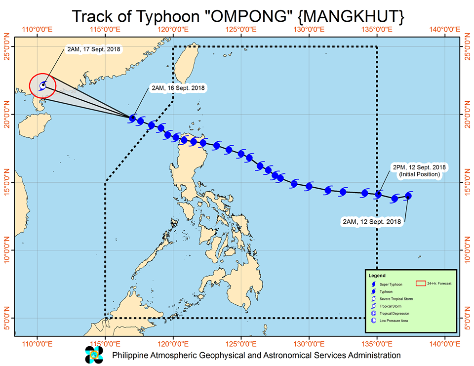
TYPHOON "OMPONG" HAS MAINTAINED ITS STRENGTH AS IT CONTINUES TO MOVE GENERALLY WEST NORTHWESTWARD TOWARDS SOUTHERN CHINA.
• The Southwest Monsoon (Habagat) enhanced by the typhoon will bring occasional gusty winds and scattered light to moderate to at times heavy rains over Western Visayas, MIMAROPA, Ilocos Region, Batangas, Bataan and Zambales. Residents in these areas, especially those living near river channels, in low-lying areas and in mountainous areas, are advised to take appropriate actions against possible flooding and landslides, coordinate with local disaster risk reduction and management offices, and to continue monitoring for updates.
• Fisherfolks and those with small seacrafts are advised not to venture out over the northern and western seaboards of Luzon.
• TCWSs elsewhere are now lifted.
Location of eye/center: At 4:00 AM today, the eye of Typhoon "OMPONG" was located based on all available data at 570 km West of Basco, Batanes (OUTSIDE PAR) (20.1°N, 116.5°E)
Strength: Maximum sustained winds of 145 km/h near the center and gustiness of up to 180 km/h
Forecast Movement: Moving West Northwest at 25 km/h
Forecast Positions:
24 Hour(Tomorrow morning): 1,215 km West of Basco, Batanes (OUTSIDE PAR)(22.1°N, 110.4°E)
NO TROPICAL CYCLONE WARNING SIGNAL
With this development and unless re-entry occurs, this is the final warning for this weather disturbance.
SOURCE: Dost_pagasa
Special thanks to:


Comments